|
This is a intermediate trail which includes the first part of the Aiea
Loop Trail.
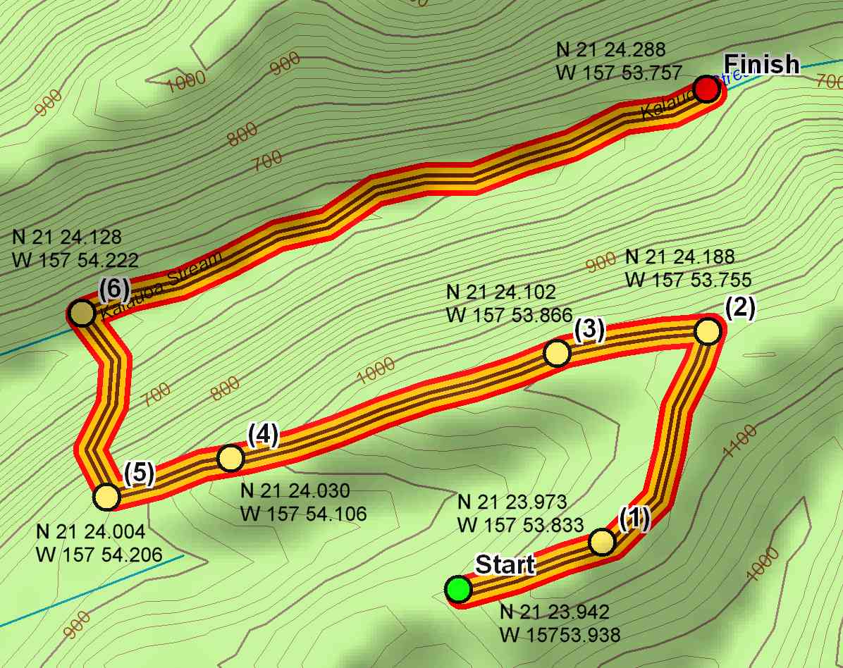
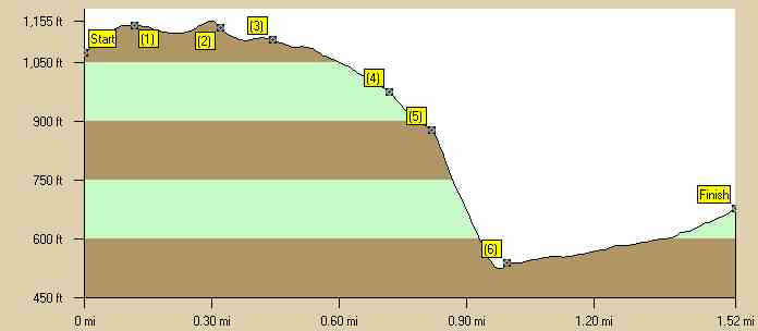
Start at the upper parking lot for the Aiea Loop Trail. The intermediate
portion is because of the steep drop one takes to get into a valley
which during the winter months has a small stream. At the end of the
trail when the stream is flowing is a water fall and small pool at the
bottom of the waterfall. If you want some major exercise on a
short trail this is the trail for you. You will encounter very few
people on this hike. The hiking time is 2-1/2 to 3 hours. Getting GPS coordinates in the valley is very difficult because of the vegetation and high valley walls. Estimated burn: 700 calories There are no caches on this trail. |
|
|
Directions to Trail (MapQuest) Download GPS Waypoints of the Pictures Print Maps and Elevation Profiles Kalauao Trail 3D Streaming View (WMP9)
|