Olomana Trail

Return to Homepage


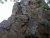
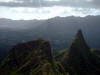
Olomana Summit 360 Panoramic View
  Move cursor over picture while holding down left mouse button

Zoom InZoom OutShow/Hide HotspotsHelpInfoAuto Pan


This is a intermediate trail starts just before the Luana Hills Golf Course. Hikers must park outside the golf course area.  They, however, do allow hikers to walk up a paved road within the country club in order to get to the trail. The intermediate portion is because of the upper portion of the trail where it becomes very narrow and requires one to climb over many boulders and rocks.  The hiking time is 2 - 2 1/2 hours.

Estimated burn: 950 calories

There is one geocache on this trail called "Olomana Ridge" at N 21 22.207 W 157 45.475.


Directions to Trail (MapQuest)

Download GPS Waypoints of the Pictures

Print Maps and Elevation Profiles

Olomana 3D Streaming View (WMP9)


Click on thumbnails or topo map to bring up pictures.

S

1

2

3

4

5


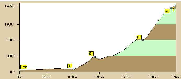
Olomana Trail Elevation Profile