|
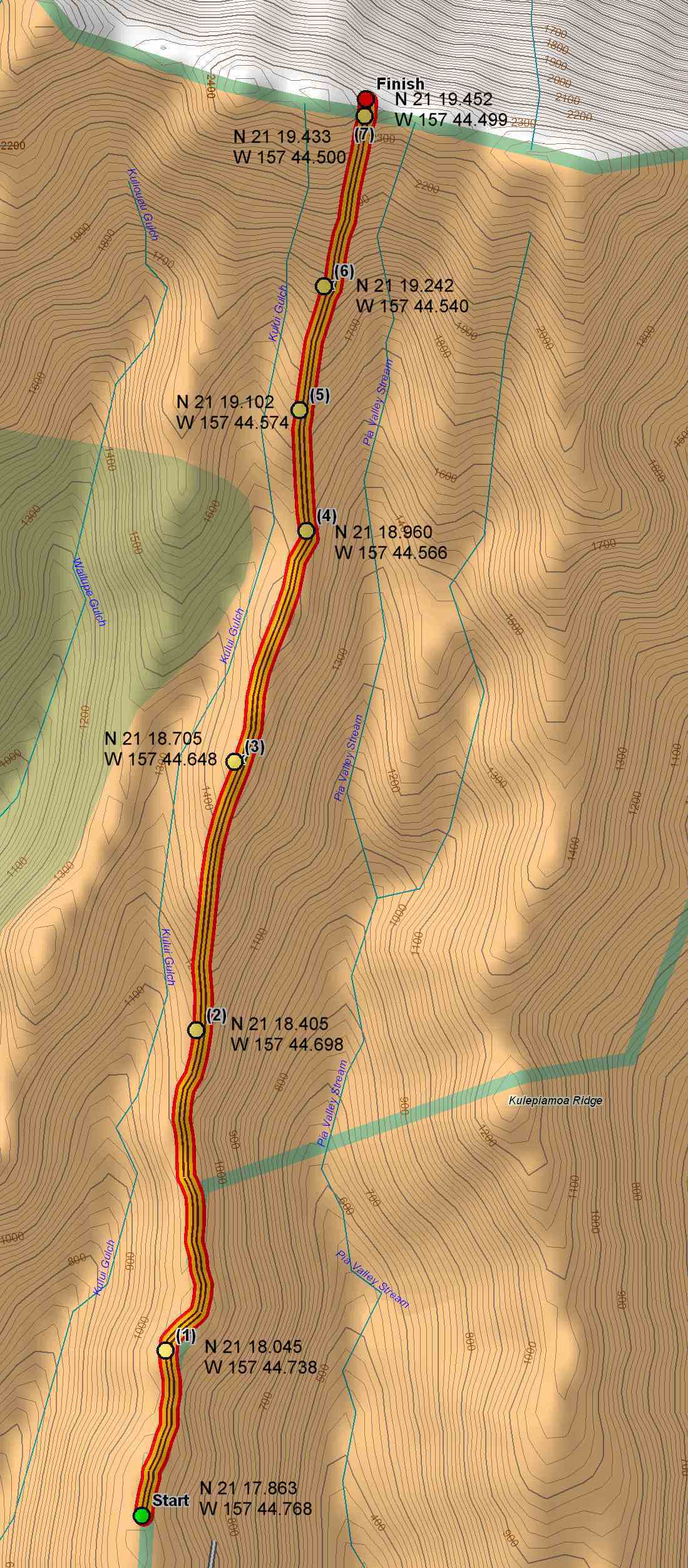
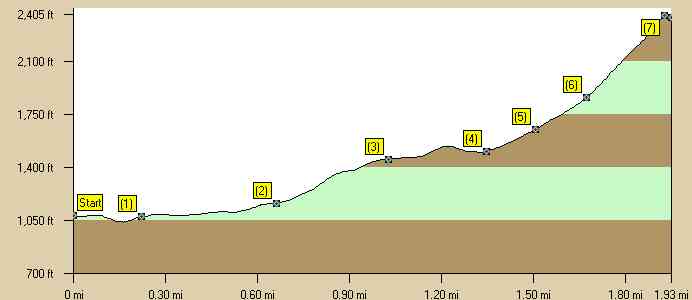
This is an intermediate trail which starts at a park on the north end of the Hawaii Loa subdivision (midway between Kahala and Hawaii Kai). You must go through security and get a pass before entering the subdivision. In order to get a pass you must have a valid Hawaii driver's license. There is plenty of good parking in a small park at the top of the subdivision. The trail starts on a ridge at about 1000 feet and then follows the ups and downs of the ridge to the summit. The last 1/2 mile is the most strenuous. The hiking time is 3 1/2- 4 hours. Estimated burn: 1000 calories There is one geocache located on the trail: Hawaii Loa Ridge Plastic Cache. (N 21 19.456 W 157 44.503). |
|
Directions to trail (MapQuest) Download GPS Waypoints of the Pictures Print Maps and Elevation Profiles Hawaii Loa Trail 3D Streaming View (WMP9)
|
|
Click on thumbnails or topo map to bring up pictures |
|
8 |
|
|
|
7 |
|
|
|
6 |
|
|
|
5 |
|
|
|
4 |
|
|
|
3 |
|
|
|
2 |
|
|
|
1 |
|
|
|
S |
|
|
Hawaii Loa Trail Elevation Profile |
|
|